Friday, May 24, 2013

Day 37:Acton KOA - Hiker Heaven/ Agua Dulce (mi 444-454)

We had an early departure, where we passed the golden spike (point of PCT completion),  and climbed into the interesting Vasquez geological formation. 
Passssing the Golden Spike
Smiles with fruitcake-like metamorphic rocks behind at sunrise. 

We had a beautiful, easy walk  where I contemplated what I wanted to do after the hike and where my motivations lay. I became increasingly convinced that returning to graduate school was in my future, however I was also convinced that I would need to work and secure funding before doing so. Hopefully I will be able to come up with some fruitful ideas on this trek... 
Smiles heading into the oddly-shaped rocks nearby the Vasquez formation. 

A tunnel in the shape of the PCT emblem burrows beneath Highway 14.

We crossed under highway 14 by way of a concrete tunnel in the familiar shape of the PCT emblem. Once through, we were in the Vasquez formation park. Beautiful sandstone formations set off-kilter by faulting towered around us as we wove in and out of caves and ravines. 


Old high school buddies and trail comrades Smiles and Rocky pause amidst the rocks for a photo. 


Pocketed sandstone rocks created excellent bird roosts. 

Dr. Slosh in front of some exposed rocks. 
Rocky (left) and Smiles (right) hot on track to Hiker Heaven. 

The PCT wove along canyon floors for a stretch. 

Hopefully this was not news to any hikers at this point. 

After a brief climb, the trail exits the canyons and follows a topographic bench north to Agua Dulce, with peaked, tilted slabs fringing the border. 

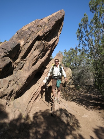
Following along a formation. 
Almost there! More odd-shaped sandstone. 

A sign spotted en route to Hiker Heaven. Most curious. 

We left the park and arrived at hiker heaven after a bit of the road walk. The lady at the grocery store seemed relatively assured that somebody would pick us up and give us a ride the rest of the way but, alas, no such luck. Hiker Heaven was a trip. Nothing short of insane/accurate name, as we were greeted by Trail Angels providing an instructional tour on the proper operations. Free laundry (done by Donna Saufley and Trail Angels), showers, and 40+hikers lounging around the expansive yard was about all we could take in off the bat. We secured sleeping space on cots, as all indoor accommodations were taken, and picked up our mail. My mom sent a nutritious, surprise, care package and some much-needed new shoes
Time to go! Old shoes served me well but they were floppy and beat up. 

We spent the rest of the day taking care of various chores, frantically trying to update blogs, and otherwise lounging and relaxing the tired feet. 
One of many Epsom salt foot baths at Hiker Heaven. 

Starfox tests the photographic capabilities of the S-110. 

Day 35: Three Points Trailhead - Poodledog ridge (mi 403-427)

Smiles so close to her adolescent home: looking south at Mt. Wilson from the Station Fire detour.  


Adrift at sea without water to drink. The poodledog bush was everywhere today, and it was as visually and olfactorily distracting as a High Times convention. 

Our bear hang the night before was successful, and our food was not ravaged by bears or vehicles over 7 feet tall. Birds were calling and singing all morning as we broke camp by dawn. Normally I would have enjoyed the birds, but I was too sleepy to figure out what they were and instead they caused me much vexation. We started hiking and I was still so groggy that i very nearly walked right off the trail. I requested a stop two miles in, where smiles and I tag-teamed a cup of instant coffee ticktock gifted us. What a game changer! I nearly instantly id'd the bird that had vexed me all morning (mountain quail) and was off like a rocket. It was a fairly bland walk through a maze of poodledog bush,  with the highlights coming in the forms of black-headed grosbeak, cañon wrens, and the ubiquitous forms of spiny lizard. When we arrived at the Mill Creek firehouse for lunch, I confirmed that we had walked beneath the TRTP alignment that my old coworkers worked on. I shot them a brief hello, then sat around with fellow hiker trash. 
Redundant acronyms: a severe pet peeve. Spotted next to a 500 kV TRTP tower. 


 I couldn't stay long, as the proximity to an active linear transmission project made me feel like I was back at work and I got needlessly stressed. 
Too much like work! Traumatic memories forced me onward as I saw construction workers breaking rules. 

We fired the motors back up and headed west through the Station Fire burn once again. Initially, the trail had been maintained well, but eventually the poodledog bush crept in on the trail with vigor. Sour cream and I were chatting and hiking at a vigorous pace, touching on topics such as scholastic ambitions, general wildlife trivia, and mountaineering. For better or worse, we didn't stop to zip our pant legs back on when the PDB thickened back up. We even blew past where our campsite was supposed to be by 3/10 of a mile. It had been claimed by PDB anyways. 
Hillsides were lousy with poodledog bush. A nuisance to hikers but crucial to the landscape following a fire. 

Smiles joined back up with us and we pressed on while looking for anywhere decent to set down a ground cloth, but to no avail. Finally we came close to a USFS road, and I popped up to see what the camping situation looked like. Sour cream looked at a spot down below occupied by Turtle and her husband, but it was not big enough for more hikers. Starfox, GW, & Busted were up by the road, and we joined them on an expansive flat spot off the road. I cooked up a nice mushroom and pork stroganoff, and we three dreamed of the KOA. 


Sour Cream and Smiles atop the ridge. 

Ms. Dirty Feet! Smiles after a day at work. 

Day 34: Little Jimmy Springs - Three Points Trailhead (mi 384-403.5)

Passing the 400 mile mark! 

A slow-paced day from the get-go, we didn't bother rousing from the tent until 745 and didn't start hiking until 9.  A good smattering of American robins, fox sparrows, western wood pewees, olive sided flycatchers, dark eyed juncos and mountain chickadees provided a sonic backdrop to the conifers of the San Gabriels as we worked our way to the Mt. Islip saddle trailhead. 
The conversation was a little bit mad, as we discussed the proper location and characters to portray if one were to get "Law & Order" tattoos.  by the time we arrived 2 miles later, the duct tape moleskins I applied to my assorted hotspots had given up. A quick leukotape repair and a glance at the maps, and we were off towards the old Endangerd Species Detour, the new one adding some 18 miles of shabby trail and several thousand unnecessary vertical feet to avoid a 2.7 mile walk on highway 2. 

We heaved over Mt. Williamson, then dropped back over to hwy 2. Yellow-rumped warblers confounded me with their singing on the way down, as I was still rusty on my mountain woodland birds. We happily walked the road in lieu of the longer detour, and encountered Trail Angel Ruby along the way, who hooked us up with Capri Suns ( which reminded us both of youth soccer). 
Smiles scoots along Highway 2 to avoid endangered Sierra Madre yellow-legged frog (Rana muscosa) critical habitat. 


We arrived at Buckhorn Flat campground, and were somewhat surprised to be greeted by t-Rex and tick tock, since they left camp a cool couple hours before us and were quicker hikers. It turned out that Rocky an Carrot had fallen ill, and they all stopped to recuperate and strategize. While eating and perusing the map with them, I realized that the trail we were about to take to complete the detour dropped us 700 feet onto the PCT, only to climb 1300 feet back to highway 2 in 4 pct miles. A 1.5 mile road walk from our location bypassed that, and also kept us out of potential MYLF habitat (which was the reason for the multiple detours to begin with). The Buckhorn campsite was quite beautiful, with enormous cedar and sugar pine lining the small valley. We walked for 20 minutes on hwy 2 and rejoined the PCT. Two miles later, we passed the 400-mile mark and met up with a slightly lonely Sour Cream, who had pressed on in front of the Portland crew at their behest after illness struck. Along with approximately 3 dozen honeybees, We tanked up on water at a dilapidated Boy Scout camp, then walked together to the Three Points trailhead. Right beforehand we received an inkling of what was to come: the 2011 Station Fire remnants. 
Burned area warning sign, with an unofficial addendum for poodledog bush. 

Trail sign with poodledog bush right behind: an ominous omen of what lay ahead. 

We made camp there, as it had many luxuries: trash cans, bathrooms, and picnic tables. We shared conversation and dinner as we got to know Sour Cream better. He and I constructed a properly executed but poorly designed (=too short) counterbalanced bear hang to protect our food from the two to three bears in the whole range. Nearby, the lights of LA lit up the periphery of the skyline as we drifted off to sleep in advance of a long, potentially hot hike in the morning. 


Day 33: Wrightwood - Little Jimmy CG

Smiles headed out of the saddle at Inspiration Point with Mt. Baden Powell in the background. 

The tables turned today, with Smiles faring better overall than I when all was said and done. I fell asleep watching war movies on TNT at the semi run-down/hiker Pines motel (i.e., there was no plug for the bedside lamp. Just bare wires.) in Wrightwood following a hearty Mexican food dinner with Team Tingo. When I woke up at 6 AM today, Law & Order was on TV. There goes the early departure. We dragged our checkout until the last permissible time - 11 AM- and pow-wowed with Tingo while we mustered the ambition to hitch a ride to the summit and resume the trek. We weren't hitching but 5 minutes until a nice lady in a new-looking WRX pulled a u-turn to pick us up. When we loaded our bags in her trunk, we saw a 49ers license plate frame. We were in good company. 

A rolling, 5-mile descent led us from the saddle at inspiration point to the Mt. Baden Powell trailhead. We took a quick lunch to try and work through the obscene amount of food we both had, but I nearly had to force myself to eat. Strike 1.  I also warmed up the hot spots I had going on before Wrightwood, which poorly affected my gait. 

Smiles standing between a couple very, very old pines near the top of Mt. Baden Powell. 

The climb up Baden Powell was the best part of the day. The trail was beautiful and well-graded, if a little crowded. The mountain resembled a moonscape of piled, gray scree with cedar, pine and fir trees hundreds of years old poking through the steep talus slopes. 

Ascending the summit ridge from the north. 

Photo looking east from the summit ridge back towards Mt. Baldy. Quite a drop!

The summit, looking like a summit: nowhere to go but down, not much on the ground. 

A gnarled limber pine (Pinus flexilis)upwards of 2,000 years old near the Mt. Baden-Powell summit

We summited and departed the final 6 miles to camp, when the indigestion generated by the Mexican food the night before kicked into high gear and started a firey case of chafe. To make matters worse, the descent off the summit reminded me that I did indeed need larger shoes, with my toes cramming into the end of the shoe with each awkward, chafe- and blister-influenced step. It really was beautiful on the high ridges of the San Gabriel mountains. The cities and suburbia of the greater LA area were invisible beneath a blanket of smog, which allowed a brief suspension of disbelief that we were not adjacent to one of the large population centers of the USA. gnarled limber pines along the ridges told tales of hostile conditions as we kept dropping down (the proper name for the formations being krummholtz). 
Dr. Slosh with the high San Gabriels in the background. 

We got into camp at our normal time (dusk) and touched base with Rocky, t-Rex, carrot, sour cream and chik-chak before making camp. I discovered that I wandered off from Arrastre trail camp on the southeast side of Big Bear without my tent stakes, but we were able to pitch freestanding. More gear to buy. After a hot ramen dinner, we quasi bear proofed camp by shoving our OP sacks in cast iron and stone camp ovens, journaled, and hit the hay. 


Day 31: San Andreas ridge - Wrightwood (mi 350-367)


Smiles at 7,200 feet after we climbed above the fog in the San Gabriels towards Mt. Baldy. 

A fitting end to a long week and the first month of the hike! Last night when we fell asleep, we were cowboy camping under a clear starry sky in the desert at an elevation of 5,000 feet, which was 1,500 feet higher than the nearest valley floor.   When we woke up today, it seemed like we had been transported to near sea level on the Pacific coast at Point Reyes, as a pea-soup thick layer of fog had descended on us in the night. We grumbled aggressively at the lousy conditions at our 5:30 am wakeup, adjusted our packs accordingly (it is poor form to stuff a wet sleeping bag, and ours were drenched with fog). Our first road crossing 1.5 miles in brought us to the first of many poodledog detours, so we took it. ,While hiking along the ridge road, we heard shrieks in the distance. It turned out that a rather hot and aggressive scorpion had crawled into Hot Mess' backpack, much to her alarm:


Once we hit 6,500 feet on the ridge, the fog momentarily broke, which revealed the fact that we were indeed on the top of a very steep ridge (recently afflicted by fire).


We stopped for a break to dry our down-containing gear, and were shortly joined by Sour Cream and Carrot, whom we had passed at camp one mile before we set ours on the previous night. We groused about poodledog bush and the steep road, then Sagitar, Spark and Track Meet showed up (in reverse order). We continued our climb through the chauss and scree mountains which transitioned from chaparral to conifers at around 7,000 feet. I found a dead tarantula on the side of the trail, turned it over,

put it on a rock, then built a cairn and placed it on top as my 'artistic' contribution to the trail. Some people scrawl in the sand, others build cones of pine cones; I build spider cairns. 


 PROOF! (Update: I have had no fewer than a dozen hikers ask/show me pictures of the "awesome tarantula sunning itself on the side of the trail. Dr. Slosh strikes again!)

Still holding fast to our goal of getting in town with time to send outgoing mail that afternoon, we entered town by way of the Acorn Trail, which drops 2,500 feet in 4 miles.

A view from the PCT looking down at Wrightwood, which the highway (the grey strip) runs through some 2,500 feet below.
The Acorn Trail itself dropped 1,500 feet in 2.1 miles, and didn't start its descent in earnest until .5 mile from the junction. It was a brutal knee- and foot-pounder, with plenty of off-camber and loose rocks to foul a tired, town-bound hiker up. After the trail, we descended a mile on steep, direct fire road with pointy rocks paved into the solidified mud base. After the fire road, we repeatedly rammed our feet into the fronts of our shoes for another mile. Finally, we made it. We lunched with Atlas, did our postage, and relaxed. Wrightwood was right for us at that time and that place.


Day 30: Silverwood lake- San Gabriel ridge west of the San Andreasfault (mi 325-350)


 Sunrise over Silverwood Lake - a shot for Karl, who had just queried us about the quantity and quality of sunrises and sunsets observed. Perhaps the best one of the trip!

Longest day yet. 4am wakeup and 5am departure from the wide spot in the trail we camped on next to the reservoir. Both Erin And I were in considerably poor shape at first get-go, with our blisters and sore feet and joints making themselves known. At least we were more prepared than the day before, when the heat caught us off guard, as did the post office hours in Wrightwood some 60 miles away (at that point. We had narrowed that to 40+ miles at the time we started today). As dawn broke over the reservoir,  we made ou way along its contours, swatting away clouds of gnats while listening to the departure of the nightjars and the dawn songs of the scrub locals (towhees and the like). The light of day illuminated a dominant peak to the east that was shielded from view within the Deep Creek cañon. By 7 we had departed the reservoir, and by 830 we had completed the only major climb of the day, and only had 10 or so miles until McDonalds. Now, I do not frequent Mickey d's, nor do I generally associate with such folk. However, options are really limited at the Cajon Pass transit center. Combined with a 6,000 calorie/day metabolism and way too much time to think about food that's not sitting in the bottom of your bag, a greaseball fast food restaurant starts to sound downright gourmet. 
A California whiptail (Cnemidophorous tigris tigris) was observed between Silverwood Lake and Cajon  Pass. 
After dropping down through more of the typical high desert scrub, signs of civilization became more prevalent: howling of train horns, a few random houses, high-voltage transmission lines, and the background drone of the interstate. 
A motivated Smiles heads towards signs of civilization
Just as the the day started cooking at full blast, we came upon the edge of a massive canyon of decaying, windswept sand that plummeted down towards the pass, with the PCT picking its way down the ridges to the north. 
The transit corridor of I-15 and the freight trains bisected the scene, with the San Gabriel mountains climbing from the floor in the background.  The wind was fierce, and it became clear how the canyons were created.
 
Smiles saw several of her new favorite critters - horned lizards- on the way down, and one was patient enough to provide decent photographs. 
My favorite shot of the trip to date.

Most small to medium sized lizards are preoccupied with looking around warily and running away, in that order. Horned lizards just do so in a manner that amplifies their awkward and ungainly body style. As we plodded downhill as quickly as our poor feet let us (2-3 mph, give or take) an endless amount of cars whizzed up the pass at 65 mph, an equally endless amount of cads whizzed down the pass at (presumably) more than 65 mph, and 2-4 mile long freight trains with up to 8 locomotives churned up and down the grade at remarkably short intervals. It was something altogether normal for the area, but wholly different from the surreal simplicity and bubble of life on the trail. 
Calories, ahoy!
The experience at McDonald's exacerbated the rift we felt from society, as this was about the closest interaction we would have for the duration of the trip. Erin and I were nearly delirious and certainly half-crazed as we staggered up the road from the trail, and wasted no time in ordering our first round. Plenty of other hikers were there, and it was easy to separate them from the others. A semi-disheveled appearance, dust smudges, salt stains underneath strap marks - all telltale signs of hiker trash. As promptly as our food arrived, it disappeared into my gullet. There we sat, whiling the hours away with story time, carrot, sour cream, and eventually Viking, while the 3,000 calorie grease ball I had consumed dissolved into my system. We found out that Rocky, t-Rex, and tick tock were all down for the count due to injury and illness, an were trying to hitch in from the reservoir. They arrived just as smiles and I set out again, and we made plans to meet up with them in Wrightwood.
An enormous frieght train weaving through the Vasquez formation west of the freeway, and east of the San Andreas Fault.
I love caffeine. It did such amazing things for me following the horrible lunch i had (such as, not making me feel like I had a horrible lunch). We climbed up and over some tilted granite formations uplifted by the proximal San Andreas fault. 
Self-portrait with the Vasquez rocks in the background. 
I saw many a train up close and personal, and finally identified a buzzing sound I'd been hearing as Costa's hummingbird. Then, while reorganizing my pack on a knife-edge ridge, I heard a raptor shriek that I hadn't before. After a quick review of field guides and observation, I found the birds to be a nesting pair of prairie falcons. 
Prairie falcon habitat.
Time snuck up on me, and I made a hasty dash to catch up with Smiles. She was waiting at the cache, and we made dusk ascent into the San Gabriel's to cap the day. We again cowboy camped at a wide spot in the road, though this one was narrower, and far inferior. 

Coolest critters: postcard perfect horned lizard, Costa's hummingbird calling and diving in San Andreas rift zone (finally id'd. Been hearing for the last few days). Pair of prairie falcons on a cliff